
|
|
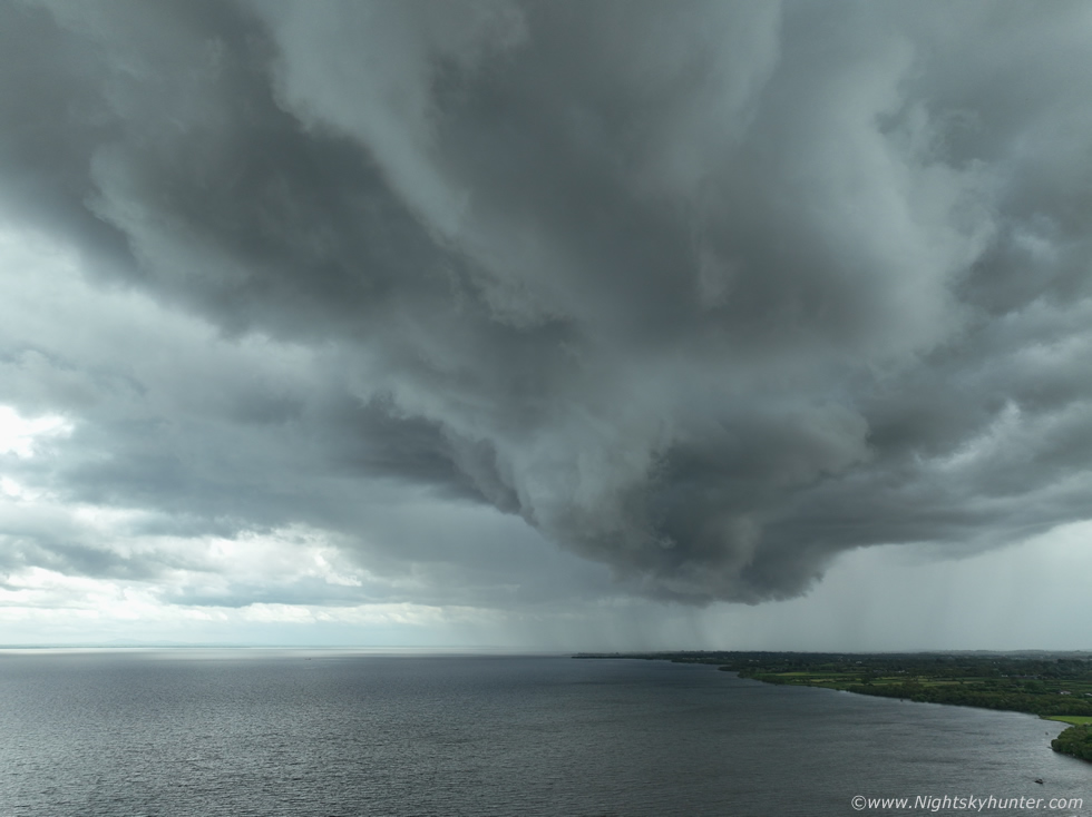 |
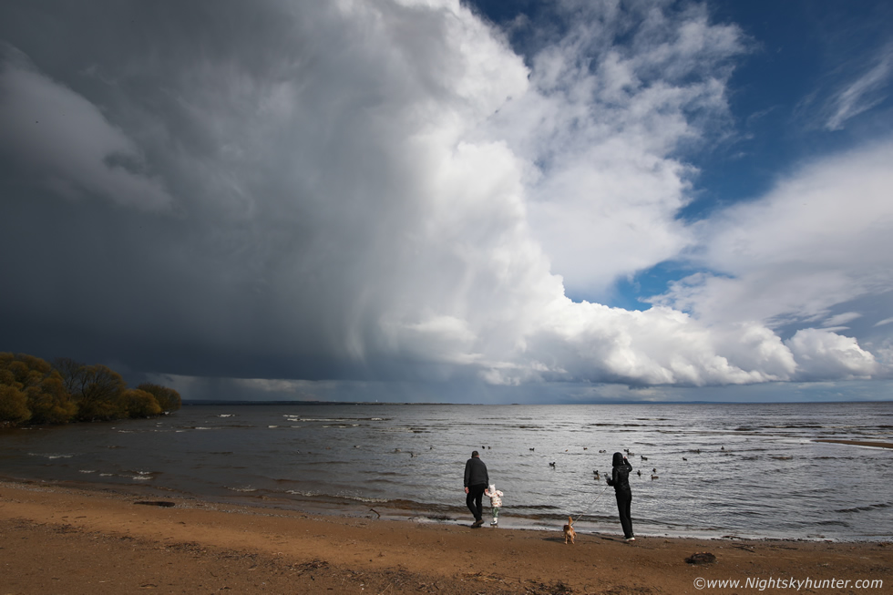
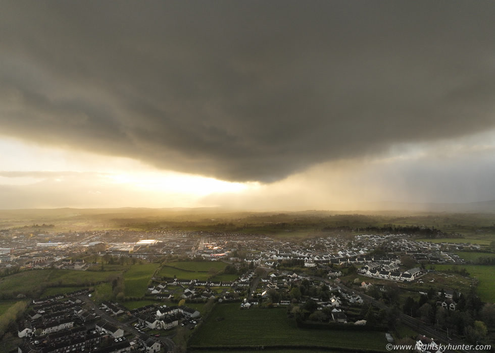
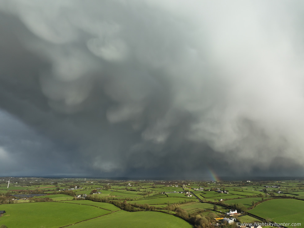
New report covering the period from late April to late May beginning with coverage of gorgeous high pressure weather, filming of rapeseed fields and a visit to the site of a World War II fighter plane crash on Lough Foyle. The highlight of this period was the shift back to unstable weather and several days with storm potential. May 17th introduced warm unstable air with very cold tops and moderate CAPE, a few storms were anticipated. I spent the day at Lough Neagh and captured two strong cell clusters/lines with intense precip cores passing over the lough, both exhibited mean gust fronts and dramatic lowerings and my first proper warm season structure of the season. The second cell became a strong thunderstorm over E. Antrim and the storm of the day in the entire country. One page report with 22 images. - REPORT.
 |
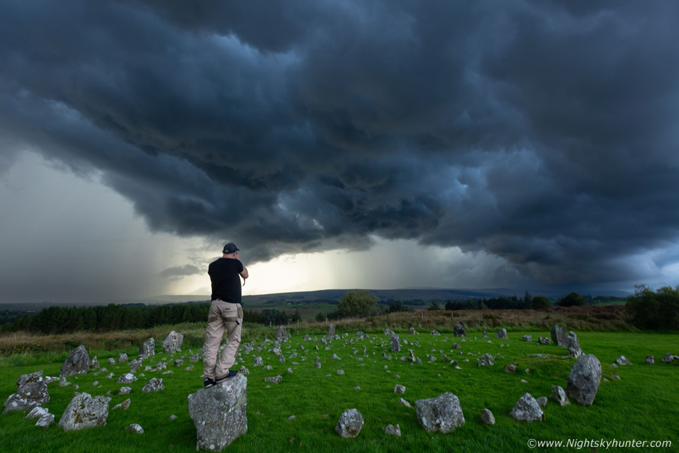
April 15th 2026 was the first proper storm set-up of early Spring when warm moist air advected across Ireland behind a cold front and ahead of a trough with -30c upper cool pool and 600 to 800j/kg of CAPE with enough shear for multicell clusters. I spent the day chasing in Co. Tyrone where models indicated the best chance of storms however it was a challenging day with constant driving E to W and W to E with little to show for it. I finally got a respectable gust front on a cluster E of Omagh. I then drove E to seek strong heating at Lough Neagh and upon arrival got treated to my first storm of the season at Ballyronan Marina with a nice sunlit flanking area over the lough itself. This was my first thunder in seven months and it was worth the wait, the new season is now underway. One page report with 15 images and one video vlog. - REPORT.
 |
A classic period of 'April showers' dominated the pattern for early Spring thanks to a cool pool aloft and low end CAPE however all balanced by exceptionally strong wind shear. Easter 2026 was a day of wintry showers with a chance of thunder. A cell passed over bringing blowing hailstones and wet snow to Cookstown and as it cleared it presented a nice sunlit anvil with mammatus over the countryside. On April 8th a chase day in the Sperrins yielded little however when I arrived home before sunset a dramatic strongly sheared rain free updraught base appeared in the west back-lit by the sun with structure I had never seen before in any April. The cell made for an unexpected impressive sight before intense rainfall ended the show. One page report with 6 images. - REPORT.
 |
After a long drought of photo opportunities things finally turned around during late March when a cold unstable air mass with strong wind shear brought back to back days of convective hail showers and even a few thunderstorms across N. Ireland. I did a local chase in the Sperrins on the 25th encountering nasty horizontal hailstones in 30mph gusts however it was on the 27th when the tables finally turned. A late evening cluster of hail cores passed over Cookstown and in the clearance where the sun broke out the cell's flank sported dripping hail and a formation of impressive mammatus pouches under a brilliant white anvil. I got the drone in the air for a look while battling strong gusts of wind, this turned out to be my first 'cool skies' of 2026. One page report with 16 images and two videos. - REPORT.
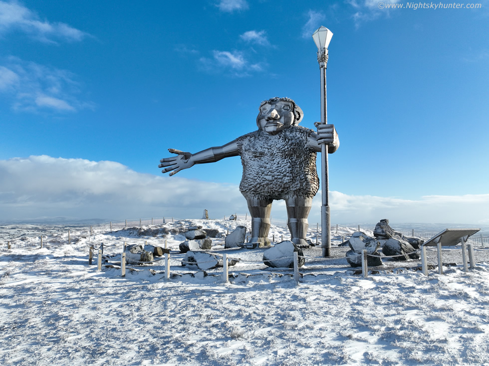 |
It's a brand new year and with it came a five day cold spell thanks to deep Arctic air and Nly flow which brought numerous snow showers across N. Ireland throughout the period. We had snow on the hills every day and at least three days of laying snow at low levels. I wanted to do something different and get 2026 off to a good start so we hiked through Gortin Glen Forest Park outside Omagh on a 7.6km round trip, half of it uphill, and captured the famous Sperrins giant 'Darach' covered in snow and obtained our first ever winter footage of this famous area. This was a great hike, surrounded by snow, crisp clean air, good exercise and a lot of fun. One page report with 26 images and 1 video vlog. - REPORT.
 |
Astronomy is not the only subject I'm interested in, check out my N. Ireland Storm Chasing section and view the chase reports and images which detail not only storms but other phenomena such as a moonbows, noctilucent clouds, aurora displays and exciting nature related photo shoots.
Martin McKenna
Home